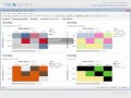
Understanding Heat Maps and Dendrograms
Interactive Video
•
Computers
•
10th - 12th Grade
•
Practice Problem
•
Hard

Patricia Brown
FREE Resource
Read more
10 questions
Show all answers
1.
MULTIPLE CHOICE QUESTION
30 sec • 1 pt
What is the primary function of a heat map in data visualization?
To use color to represent data values
To display numerical values in a table format
To create 3D models of data
To replace data values with text descriptions
2.
MULTIPLE CHOICE QUESTION
30 sec • 1 pt
In a heat map, what does the color of a cell typically represent?
The source of the data
The value of the data
The type of data
The size of the data set
3.
MULTIPLE CHOICE QUESTION
30 sec • 1 pt
What is one advantage of using heat maps over traditional tables?
They are easier to print
They require less data
They can only display small data sets
They use less space by replacing numbers with colors
4.
MULTIPLE CHOICE QUESTION
30 sec • 1 pt
How can heat maps help in understanding customer purchase patterns?
By providing text summaries of data
By displaying 3D graphs
By showing detailed numerical values
By highlighting color patterns that indicate trends
5.
MULTIPLE CHOICE QUESTION
30 sec • 1 pt
What is a key feature of heat maps that makes them useful for large data sets?
They provide detailed numerical analysis
They can display 3D models
They use color to represent data, saving space
They are interactive and animated
6.
MULTIPLE CHOICE QUESTION
30 sec • 1 pt
What does a blue tint in a heat map cell typically indicate?
An average value
A high value
A missing value
A low value
7.
MULTIPLE CHOICE QUESTION
30 sec • 1 pt
What is the default color scheme for a heat map?
Black-white
Blue-grey-red
Purple-orange
Red-yellow-green
Access all questions and much more by creating a free account
Create resources
Host any resource
Get auto-graded reports
Continue with Google

Continue with Email
Continue with Classlink
Continue with Clever
or continue with
Microsoft
%20(1).png)
Apple
Others
Already have an account?
