Urban Expansion Analysis Techniques
Interactive Video
•
Geography
•
9th - 10th Grade
•
Practice Problem
•
Hard

Patricia Brown
FREE Resource
Read more
10 questions
Show all answers
1.
MULTIPLE CHOICE QUESTION
30 sec • 1 pt
What is the primary focus of the video tutorial?
Learning a new programming language
Studying urban expansion using gradient direction
Building a mobile application
Creating a website
2.
MULTIPLE CHOICE QUESTION
30 sec • 1 pt
Which method is used to estimate land cover areas in the tutorial?
Gradient direction
Satellite imagery
Field surveys
Aerial photography
3.
MULTIPLE CHOICE QUESTION
30 sec • 1 pt
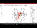
How many gradient directions are mentioned in the research papers discussed?
8
4
16
12
4.
MULTIPLE CHOICE QUESTION
30 sec • 1 pt
What is the first step in creating a buffer from the CBD point?
Merge files
Set up snapping options
Select the analysis tool
Create a new shapefile
5.
MULTIPLE CHOICE QUESTION
30 sec • 1 pt
What is the buffer unit used in the tutorial?
Kilometers
Miles
Meters
Feet
6.
MULTIPLE CHOICE QUESTION
30 sec • 1 pt
What type of file is created for gradient directions?
Raster file
Image file
Shapefile
Text file
7.
MULTIPLE CHOICE QUESTION
30 sec • 1 pt
What is the purpose of setting up snapping options?
To reduce file size
To increase processing speed
To ensure accurate alignment of features
To enhance image quality
Access all questions and much more by creating a free account
Create resources
Host any resource
Get auto-graded reports
Continue with Google

Continue with Email
Continue with Classlink
Continue with Clever
or continue with
Microsoft
%20(1).png)
Apple
Others
Already have an account?
