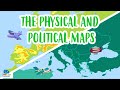
Understanding Maps and Their Uses
Interactive Video
•
Geography
•
3rd - 6th Grade
•
Practice Problem
•
Medium

Emma Peterson
Used 11+ times
FREE Resource
Read more
10 questions
Show all answers
1.
MULTIPLE CHOICE QUESTION
30 sec • 1 pt
What modern technology in cars helps drivers navigate without getting lost?
Bluetooth
Air Conditioning
GPS
Radio
2.
MULTIPLE CHOICE QUESTION
30 sec • 1 pt
How can maps be described in terms of their function?
A device for measuring distance
A graphic representation of the Earth's surface
A method for predicting weather
A tool for drawing
3.
MULTIPLE CHOICE QUESTION
30 sec • 1 pt
Which type of map shows the division of continents, countries, and cities?
Climate map
Political map
Tourist map
Physical map
4.
MULTIPLE CHOICE QUESTION
30 sec • 1 pt
What do physical maps display in addition to cities and countries?
Historical events
Mountains and rivers
Climate zones
Tourist attractions
5.
MULTIPLE CHOICE QUESTION
30 sec • 1 pt
Which of the following is NOT a type of map mentioned in the video?
Hydrographic map
Climate map
Astronomical map
Tourist map
6.
MULTIPLE CHOICE QUESTION
30 sec • 1 pt
What is the purpose of a compass rose on a map?
To show the scale of the map
To indicate the cardinal points
To highlight tourist spots
To display the map's legend
7.
MULTIPLE CHOICE QUESTION
30 sec • 1 pt
What does a map's scale indicate?
The distance between two points
How many times a place is reduced to fit on the map
The number of colors used
The real size of the map
Access all questions and much more by creating a free account
Create resources
Host any resource
Get auto-graded reports
Continue with Google

Continue with Email
Continue with Classlink
Continue with Clever
or continue with
Microsoft
%20(1).png)
Apple
Others
Already have an account?
