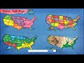
Exploring Different Types of Maps
Interactive Video
•
Social Studies
•
6th - 10th Grade
•
Practice Problem
•
Hard

Sophia Harris
FREE Resource
Read more
10 questions
Show all answers
1.
MULTIPLE CHOICE QUESTION
30 sec • 1 pt
What are the four main types of maps discussed in the video?
Political, Physical, Climate, Economic
Political, Physical, Topographic, Economic
Political, Physical, Topographic, Historical
Political, Physical, Climate, Historical
2.
MULTIPLE CHOICE QUESTION
30 sec • 1 pt
What does a political map primarily show?
State and national boundaries
Mountains and rivers
Climate regions
Historical events
3.
MULTIPLE CHOICE QUESTION
30 sec • 1 pt
Which of the following is NOT typically shown on a political map?
State boundaries
Large cities
Mountain elevations
National boundaries
4.
MULTIPLE CHOICE QUESTION
30 sec • 1 pt
What color is typically used to represent bodies of water on a physical map?
Green
Blue
Brown
Red
5.
MULTIPLE CHOICE QUESTION
30 sec • 1 pt
What does a physical map show besides rivers, lakes, and mountains?
Historical events
State boundaries
National boundaries
Elevations of mountain regions
6.
MULTIPLE CHOICE QUESTION
30 sec • 1 pt
What type of map would show different climatic areas?
Physical map
Climate map
Political map
Historical map
7.
MULTIPLE CHOICE QUESTION
30 sec • 1 pt
Which of the following is NOT a climatic area shown on a climate map?
Mountainous
Cool
Hot arid
Temperate
Access all questions and much more by creating a free account
Create resources
Host any resource
Get auto-graded reports
Continue with Google

Continue with Email
Continue with Classlink
Continue with Clever
or continue with
Microsoft
%20(1).png)
Apple
Others
Already have an account?
