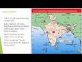
Geography and Strategic Importance of Pakistan
Interactive Video
•
Geography
•
6th - 7th Grade
•
Practice Problem
•
Hard

Patricia Brown
FREE Resource
Read more
10 questions
Show all answers
1.
MULTIPLE CHOICE QUESTION
30 sec • 1 pt
Which country is located to the east of Pakistan?
Iran
India
China
Afghanistan
2.
MULTIPLE CHOICE QUESTION
30 sec • 1 pt
What body of water lies to the south of Pakistan?
Red Sea
Bay of Bengal
Arabian Sea
Mediterranean Sea
3.
MULTIPLE CHOICE QUESTION
30 sec • 1 pt
Which countries are considered part of South Asia?
India, Nepal, Bhutan
Pakistan, China, Japan
Sri Lanka, Maldives, Indonesia
Bangladesh, Myanmar, Thailand
4.
MULTIPLE CHOICE QUESTION
30 sec • 1 pt
What does the term 'subcontinent' refer to?
A desert region
A group of islands
A large landmass smaller than a continent
A small island
5.
MULTIPLE CHOICE QUESTION
30 sec • 1 pt
What does SAARC stand for?
South Asian Association for Regional Cooperation
South American Association for Regional Cooperation
Southeast Asian Association for Regional Cooperation
South African Association for Regional Cooperation
6.
MULTIPLE CHOICE QUESTION
30 sec • 1 pt
Why are Islamic countries often represented in green on maps?
Green is the color of peace
Green is the color of nature
Green is a traditional color of Islam
Green is the color of prosperity
7.
MULTIPLE CHOICE QUESTION
30 sec • 1 pt
Which continents are shown in the map of Muslim countries?
Europe, Africa, South America
Asia, Australia, Antarctica
North America, South America, Europe
Africa, Europe, Asia
Access all questions and much more by creating a free account
Create resources
Host any resource
Get auto-graded reports
Continue with Google

Continue with Email
Continue with Microsoft
or continue with

%20(1).png)
Apple
Others
Already have an account?
