Understanding the WGS84 System
Interactive Video
•
Geography
•
9th - 10th Grade
•
Practice Problem
•
Hard

Patricia Brown
FREE Resource
Read more
10 questions
Show all answers
1.
MULTIPLE CHOICE QUESTION
30 sec • 1 pt
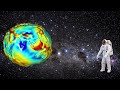
What does the red zone in the Earth's gravity model indicate?
No gravity
Equal gravity
Higher gravity
Lower gravity
2.
MULTIPLE CHOICE QUESTION
30 sec • 1 pt
What is the shape of the Earth called when it is squished at the poles and bulged at the equator?
Cylinder
Oblate spheroid
Perfect sphere
Ellipsoid
3.
MULTIPLE CHOICE QUESTION
30 sec • 1 pt
What is the equatorial radius of the Earth according to the simplified model?
6300 km
6400 km
6378.137 km
6356.752 km
4.
MULTIPLE CHOICE QUESTION
30 sec • 1 pt
What is the WGS84 ellipsoid primarily used for?
Measuring gravity
Measuring time
Measuring temperature
Measuring position and height
5.
MULTIPLE CHOICE QUESTION
30 sec • 1 pt
Where is the coordinate origin of the WGS84 ellipsoid located?
At the South Pole
At the equator
At the Earth's center of mass
At the North Pole
6.
MULTIPLE CHOICE QUESTION
30 sec • 1 pt
Why might the WGS84 system not be perfect for very accurate measurements everywhere?
It is too complex
It does not account for local area distortions
It is outdated
It is too expensive
7.
MULTIPLE CHOICE QUESTION
30 sec • 1 pt
What might happen if you are at sea level in relation to the WGS84 ellipsoid?
The ellipsoid might be below you
The ellipsoid might be above you
The ellipsoid might be at the same level
The ellipsoid might disappear
Access all questions and much more by creating a free account
Create resources
Host any resource
Get auto-graded reports
Continue with Google

Continue with Email
Continue with Classlink
Continue with Clever
or continue with
Microsoft
%20(1).png)
Apple
Others
Already have an account?
