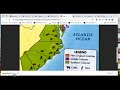
Labeling the 13 Colonies Map
Interactive Video
•
Geography, History, Social Studies
•
6th - 7th Grade
•
Practice Problem
•
Hard

Patricia Brown
FREE Resource
Read more
10 questions
Show all answers
1.
MULTIPLE CHOICE QUESTION
30 sec • 1 pt
What is the main focus of the assignment discussed by Mrs. Wilson?
Creating a timeline of the 13 colonies
Labeling the 13 colonies and their products
Writing an essay on the 13 colonies
Labeling the 13 colonies and their capitals
2.
MULTIPLE CHOICE QUESTION
30 sec • 1 pt
How many days is the assignment expected to take?
Four days
Three days
Two days
One day
3.
MULTIPLE CHOICE QUESTION
30 sec • 1 pt
What are the two options for completing the map labeling project?
Using a digital tool or drawing by hand
Using a digital tool or writing an essay
Drawing by hand or creating a presentation
Writing an essay or creating a presentation
4.
MULTIPLE CHOICE QUESTION
30 sec • 1 pt
What tool is suggested for labeling the map online?
Nearpod
Google Maps
Microsoft Paint
Adobe Photoshop
5.
MULTIPLE CHOICE QUESTION
30 sec • 1 pt
What should you do if the name of a colony doesn't fit inside its boundaries on the map?
Type it beside the colony
Leave it out
Write it on a separate sheet
Use a smaller font
6.
MULTIPLE CHOICE QUESTION
30 sec • 1 pt
What is the purpose of using symbols and images on the map?
To confuse the viewer
To represent the products of each colony
To make the map look colorful
To decorate the map
7.
MULTIPLE CHOICE QUESTION
30 sec • 1 pt
Why is it important to match the number of symbols on your map with those in the textbook?
To impress the teacher
To make the map look more detailed
To ensure accuracy in representing economic activities
To fill up space on the map
Access all questions and much more by creating a free account
Create resources
Host any resource
Get auto-graded reports
Continue with Google

Continue with Email
Continue with Classlink
Continue with Clever
or continue with
Microsoft
%20(1).png)
Apple
Others
Already have an account?
