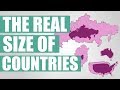
Map Distortion and Country Sizes
Interactive Video
•
Geography, Science, Mathematics
•
9th - 10th Grade
•
Practice Problem
•
Hard

Patricia Brown
FREE Resource
Read more
10 questions
Show all answers
1.
MULTIPLE CHOICE QUESTION
30 sec • 1 pt
What is the most commonly used map projection that distorts country sizes?
Winkel Tripel Projection
Mercator Projection
Peters Projection
Robinson Projection
2.
MULTIPLE CHOICE QUESTION
30 sec • 1 pt
Why does the Mercator projection distort the size of countries?
It uses a cylindrical projection method.
It is designed for aesthetic purposes.
It prioritizes equal area representation.
It focuses on accurate distance representation.
3.
MULTIPLE CHOICE QUESTION
30 sec • 1 pt
How does the size of Russia appear when moved to the equator on a map?
It becomes distorted in shape.
It appears smaller.
It appears larger.
It remains the same size.
4.
MULTIPLE CHOICE QUESTION
30 sec • 1 pt
Which country is often used to demonstrate map distortion due to its perceived size?
Australia
India
Brazil
Greenland
5.
MULTIPLE CHOICE QUESTION
30 sec • 1 pt
What happens to the perceived size of Romania when displayed further north on a map?
It appears smaller.
It becomes distorted in shape.
It appears larger.
It remains unchanged.
6.
MULTIPLE CHOICE QUESTION
30 sec • 1 pt
How does the size of California compare to the UK when moved on a map?
California appears much smaller.
California appears much larger.
The UK appears larger.
They appear similar in size.
7.
MULTIPLE CHOICE QUESTION
30 sec • 1 pt
What is the effect of moving Indonesia over Russia on a map?
Indonesia's shape becomes distorted.
Indonesia remains the same size.
Indonesia appears larger.
Indonesia appears smaller.
Access all questions and much more by creating a free account
Create resources
Host any resource
Get auto-graded reports
Continue with Google

Continue with Email
Continue with Classlink
Continue with Clever
or continue with
Microsoft
%20(1).png)
Apple
Others
Already have an account?
