Mountain Mapping and Erosion Concepts
Interactive Video
•
Science, Geography, Other
•
2nd - 3rd Grade
•
Practice Problem
•
Hard

Patricia Brown
FREE Resource
Read more
10 questions
Show all answers
1.
MULTIPLE CHOICE QUESTION
30 sec • 1 pt
What is the main focus of the lesson in the changing landforms unit?
Investigating differences in scale
Learning about different types of rocks
Studying the water cycle
Exploring animal habitats
2.
MULTIPLE CHOICE QUESTION
30 sec • 1 pt
How do geologists use maps in their studies?
To find treasure
To locate water sources
To predict weather patterns
To study landforms and changes
3.
MULTIPLE CHOICE QUESTION
30 sec • 1 pt
What question are students investigating about erosion?
How does erosion create new landforms?
How does erosion affect weather?
How can erosion of small rocks cause big changes?
What animals live in eroded areas?
4.
MULTIPLE CHOICE QUESTION
30 sec • 1 pt
What material will students use in the mountain model activity?
Clay
Pom-poms
Cotton balls
Sand
5.
MULTIPLE CHOICE QUESTION
30 sec • 1 pt
What is the purpose of the map key in the worksheet?
To display water sources
To mark animal habitats
To indicate different land elevations
To show the weather conditions
6.
MULTIPLE CHOICE QUESTION
30 sec • 1 pt
Which color represents very high land on the map key?
Blue
Brown
Yellow
Green
7.
MULTIPLE CHOICE QUESTION
30 sec • 1 pt
What should students visualize when drawing the mountain map?
The mountain during a storm
The mountain from the side
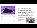
The mountain from a bird's eye view
The mountain at night
Access all questions and much more by creating a free account
Create resources
Host any resource
Get auto-graded reports
Continue with Google

Continue with Email
Continue with Classlink
Continue with Clever
or continue with
Microsoft
%20(1).png)
Apple
Others
Already have an account?
