Understanding Maps and Globes
Interactive Video
•
Social Studies, Geography
•
1st - 3rd Grade
•
Practice Problem
•
Hard

Patricia Brown
FREE Resource
Read more
10 questions
Show all answers
1.
MULTIPLE CHOICE QUESTION
30 sec • 1 pt
What materials are needed for the social studies lesson on globes and maps?
A pencil and eraser
A glue stick and scissors
A ruler and compass
A notebook and pen
2.
MULTIPLE CHOICE QUESTION
30 sec • 1 pt
What do globes primarily show us?
The weather patterns
The locations of stars
The distribution of land and water on Earth
The history of countries
3.
MULTIPLE CHOICE QUESTION
30 sec • 1 pt
Which of the following is NOT a name for the country we live in?
United States
America
Canada
USA
4.
MULTIPLE CHOICE QUESTION
30 sec • 1 pt
What is a key difference between a physical map and a political map?
Physical maps show weather patterns, while political maps show population density.
Physical maps show animal habitats, while political maps show plant distribution.
Physical maps show land and water, while political maps show cities and towns.
Physical maps show historical events, while political maps show future predictions.
5.
MULTIPLE CHOICE QUESTION
30 sec • 1 pt
What does a map's title tell us?
The scale of the map
The subject or focus of the map
The date the map was created
The author of the map
6.
MULTIPLE CHOICE QUESTION
30 sec • 1 pt
What is the purpose of a map key?
To provide a list of countries
To explain the symbols and colors on a map
To show the distance between two points
To indicate the map's scale
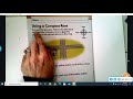
7.
MULTIPLE CHOICE QUESTION
30 sec • 1 pt
What does a compass rose on a map indicate?
The map's scale
The map's author
The map's title
The cardinal directions
Access all questions and much more by creating a free account
Create resources
Host any resource
Get auto-graded reports
Continue with Google

Continue with Email
Continue with Classlink
Continue with Clever
or continue with
Microsoft
%20(1).png)
Apple
Others
Already have an account?
