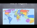
Mapping Cultural and Political Regions of the World
Interactive Video
•
Geography, History, Social Studies
•
9th - 10th Grade
•
Practice Problem
•
Hard

Patricia Brown
FREE Resource
Read more
10 questions
Show all answers
1.
MULTIPLE CHOICE QUESTION
30 sec • 1 pt
What is the primary purpose of identifying world regions?
To understand only the physical divisions
To focus solely on political boundaries
To study economic zones
To explore cultural and political divisions
2.
MULTIPLE CHOICE QUESTION
30 sec • 1 pt
Which continent is considered part of North America by geographers?
South America
Asia
Central America
Europe
3.
MULTIPLE CHOICE QUESTION
30 sec • 1 pt
What is a unique feature of the region of Asia?
It is entirely desert
It is the smallest continent
It has a uniform culture
It encompasses diverse physical and cultural geography
4.
MULTIPLE CHOICE QUESTION
30 sec • 1 pt
Which region is not shown on the map but is mentioned in the video?
The Amazon
The Arctic
Greenland
Antarctica
5.
MULTIPLE CHOICE QUESTION
30 sec • 1 pt
How is Latin America primarily defined?
By its economic status
By its political system
By its physical geography
By language and culture
6.
MULTIPLE CHOICE QUESTION
30 sec • 1 pt
What is a key distinction between Western and Eastern Europe?
Economic status
Language and political history
Geographic size
Climate differences
7.
MULTIPLE CHOICE QUESTION
30 sec • 1 pt
What factor contributes to Africa's regional divisions?
Its small size
Uniform culture
Lack of diversity
Geographic distinctions
Access all questions and much more by creating a free account
Create resources
Host any resource
Get auto-graded reports
Continue with Google

Continue with Email
Continue with Microsoft
or continue with

%20(1).png)
Apple
Others
Already have an account?
