Savass Earth
Authored by Charles Martinez
Science
8th - 10th Grade
NGSS covered

AI Actions
Add similar questions
Adjust reading levels
Convert to real-world scenario
Translate activity
More...
Content View
Student View
22 questions
Show all answers
1.
MULTIPLE CHOICE QUESTION
30 sec • 1 pt
The diagrams below represent four systems of imaginary lines that could be used to locate positions on
a planet. Which system is most similar to the latitude-longitude systems used on Earth?


2.
MULTIPLE CHOICE QUESTION
30 sec • 1 pt

The map below shows the elevation field of a 30 by 50 meter section of a parking lot on which a large
pile of sand has been dumped. The isolines show height of the sand above the surface of the parking lot
in meters. Which map represents the most likely elevation field for the same area after several heavy rainstorms?


Tags
NGSS.MS-ESS2-2
NGSS.MS-ESS2-1
NGSS.MS-ESS2-4
3.
MULTIPLE CHOICE QUESTION
30 sec • 1 pt

According to the map, Long Creek is flowing south. Which statement below is the best explanation as
to how this can be determined?
The contour lines crossing the stream
from Vs, which always point uphill
The Rule of Vs states that all streams
flow toward the bottom of a map.
The contour lines crossing the stream
form Vs, causing the stream to flow uphill
The contour lines crossing the stream
form Vs, which always point downhill
4.
MULTIPLE CHOICE QUESTION
30 sec • 1 pt

Which of the following graphs best represents the profile along line AB shown on the map?


Tags
NGSS.MS-ESS2-3
5.
MULTIPLE CHOICE QUESTION
30 sec • 1 pt

A topographic map and an incorrectly constructed profile from point A to point H on the map are
shown below. What mistake was made in the construction of this profile?
using a contour interval of 10 feet
drawing a curved line instead of a
straight line from point B to point C
plotting points A through H the same
distance apart horizontally
increasing the elevation from point F to
point H
Tags
NGSS.MS-ESS2-2
6.
MULTIPLE CHOICE QUESTION
30 sec • 1 pt

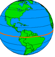
Which two location letters have the same latitude?
C and A
B and A
C and D
D and A
7.
MULTIPLE CHOICE QUESTION
30 sec • 1 pt

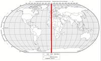
As you travel from location A to location C, how would your longitude change?
Increase
Remain the Same
Decrease
Increase and then decrease
Access all questions and much more by creating a free account
Create resources
Host any resource
Get auto-graded reports
Continue with Google

Continue with Email
Continue with Classlink
Continue with Clever
or continue with
Microsoft
%20(1).png)
Apple
Others
Already have an account?
Similar Resources on Wayground

20 questions
Static electricity
Quiz
•
7th - 9th Grade
20 questions
End of term exam - Mega Quizizz!
Quiz
•
6th - 9th Grade
20 questions
8. Sınıf 3. Quiz (3. Ünite)
Quiz
•
8th Grade
20 questions
ATOM
Quiz
•
9th Grade
17 questions
8 gaz basıncı
Quiz
•
8th Grade
20 questions
1st Year Assessment 1
Quiz
•
6th - 8th Grade
20 questions
LEMAK DAN GETAH
Quiz
•
10th - 12th Grade
18 questions
Glacier Basics
Quiz
•
8th Grade
Popular Resources on Wayground
8 questions
Spartan Way - Classroom Responsible
Quiz
•
9th - 12th Grade
15 questions
Fractions on a Number Line
Quiz
•
3rd Grade
14 questions
Boundaries & Healthy Relationships
Lesson
•
6th - 8th Grade
20 questions
Equivalent Fractions
Quiz
•
3rd Grade
3 questions
Integrity and Your Health
Lesson
•
6th - 8th Grade
25 questions
Multiplication Facts
Quiz
•
5th Grade
9 questions
FOREST Perception
Lesson
•
KG
20 questions
Main Idea and Details
Quiz
•
5th Grade
Discover more resources for Science
22 questions
Phases of the moon
Quiz
•
8th Grade
20 questions
Waves and Wave Properties
Quiz
•
6th - 8th Grade
8 questions
Amoeba Sister Asexual vs Sexual Reproduction
Interactive video
•
8th Grade
10 questions
Exploring the Rock Cycle: Types and Formation
Interactive video
•
6th - 8th Grade
20 questions
8th Grade Science STAAR Review
Quiz
•
8th Grade
25 questions
Naming Ionic and Covalent Compounds
Quiz
•
9th Grade
22 questions
Newton's Laws of Motion
Lesson
•
8th Grade
9 questions
Seasons and Earth's Tilt
Lesson
•
6th - 8th Grade