Topographic Maps Review
Authored by Natalie Campbell
Science
8th Grade
NGSS covered
Used 13+ times

AI Actions
Add similar questions
Adjust reading levels
Convert to real-world scenario
Translate activity
More...
Content View
Student View
50 questions
Show all answers
1.
MULTIPLE CHOICE QUESTION
5 mins • 1 pt

Determine the interval by counting from the smallest to the biggest number. Look for a pattern, or the number that each line ‘jumps’ by between the numbers. Each line should have a number it represents.
The interval is 10 because each line counts up by 10.
The interval is 60 because that is the biggest number.
The interval is M
2.
MULTIPLE CHOICE QUESTION
1 min • 1 pt

What is the elevation of point B?
3.
MULTIPLE CHOICE QUESTION
1 min • 1 pt
What do contour lines that are farther apart represent?
4.
MULTIPLE CHOICE QUESTION
30 sec • 1 pt

Which direction is the river flowing on this topo map?
Northeast
Southwest
East
North
5.
MULTIPLE CHOICE QUESTION
1 min • 1 pt
If contour lines are close together, then the slope is
6.
MULTIPLE CHOICE QUESTION
1 min • 1 pt
What do contour lines that are farther apart represent?
7.
MULTIPLE CHOICE QUESTION
3 mins • 1 pt

What is the difference in elevation between Point X and Point Y?
Tags
NGSS.MS-ESS2-3
Access all questions and much more by creating a free account
Create resources
Host any resource
Get auto-graded reports
Continue with Google

Continue with Email
Continue with Classlink
Continue with Clever
or continue with
Microsoft
%20(1).png)
Apple
Others
Already have an account?
Similar Resources on Wayground

55 questions
Ace Energy Transformations
Quiz
•
6th - 8th Grade
47 questions
Earth & Space Science B Review
Quiz
•
8th - 9th Grade
45 questions
7th grade Science Review
Quiz
•
7th - 8th Grade
48 questions
Ecology 7th Grade
Quiz
•
6th - 8th Grade
46 questions
13.1 Describing weather
Quiz
•
7th - 8th Grade
46 questions
Size and Distance of the Solar System
Quiz
•
5th - 8th Grade
50 questions
7. Struktur Bumi dan Dinamikanya
Quiz
•
7th - 9th Grade
50 questions
STRUCTURE OF THE EARTH
Quiz
•
5th - 8th Grade
Popular Resources on Wayground
15 questions
Fractions on a Number Line
Quiz
•
3rd Grade
10 questions
Probability Practice
Quiz
•
4th Grade
15 questions
Probability on Number LIne
Quiz
•
4th Grade
20 questions
Equivalent Fractions
Quiz
•
3rd Grade
25 questions
Multiplication Facts
Quiz
•
5th Grade
22 questions
fractions
Quiz
•
3rd Grade
6 questions
Appropriate Chromebook Usage
Lesson
•
7th Grade
10 questions
Greek Bases tele and phon
Quiz
•
6th - 8th Grade
Discover more resources for Science
10 questions
Exploring the Rock Cycle
Interactive video
•
6th - 8th Grade
8 questions
Newton's Second Law
Lesson
•
6th - 8th Grade
8 questions
Amoeba Sister Asexual vs Sexual Reproduction
Interactive video
•
8th Grade
10 questions
Exploring the Rock Cycle: Types and Formation
Interactive video
•
6th - 8th Grade
20 questions
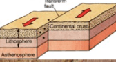
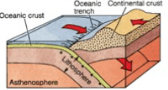
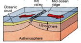
Plate Tectonics
Quiz
•
8th Grade
25 questions
Evolution and Natural Selection Review
Quiz
•
6th - 8th Grade
10 questions
Exploring Weathering, Erosion, and Deposition Processes
Interactive video
•
6th - 10th Grade
20 questions
Rock Cycle
Quiz
•
8th Grade